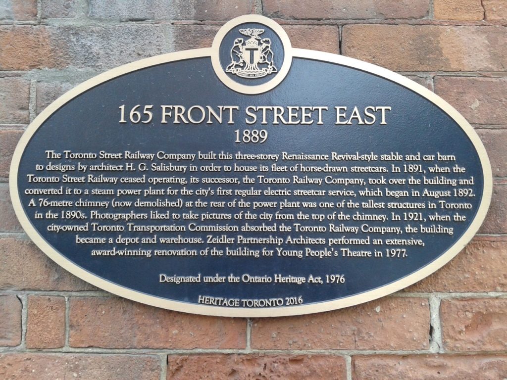
My collection of Ontario historic plaques photos has reached 250! Yesterday, in fact, was an 11-plaque day, bringing the total to 262. Created last December 2017 as a test collection for an Omeka software demonstration website, my plaques project has turned into a fun and mildly obsessive little hobby. I began with about 60 photos, …