
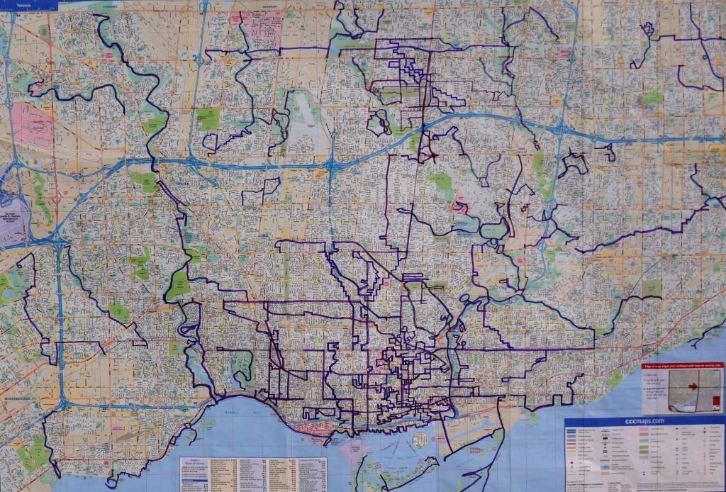
In the spring of 2021, I set out to walk as many of Toronto’s ravines and nature trails as possible (COVID-19 restrictions and weekend subway closures allowing), tracking my progress on a map in purple marker.
After varying degrees of lockdowns over the preceding winter, and since travel far afield was not happening, I was eager to get outside and explore where I could. During the year, I walked about 900 miles / 1,450 km of Toronto trails and streets, venturing east and west to parts of the city I’d never seen before (Etobicoke Creek, Rouge National Urban Park…).
Part of my interest was to understand the geography of my hometown, especially the rivers and their tributaries, to better appreciate the land.
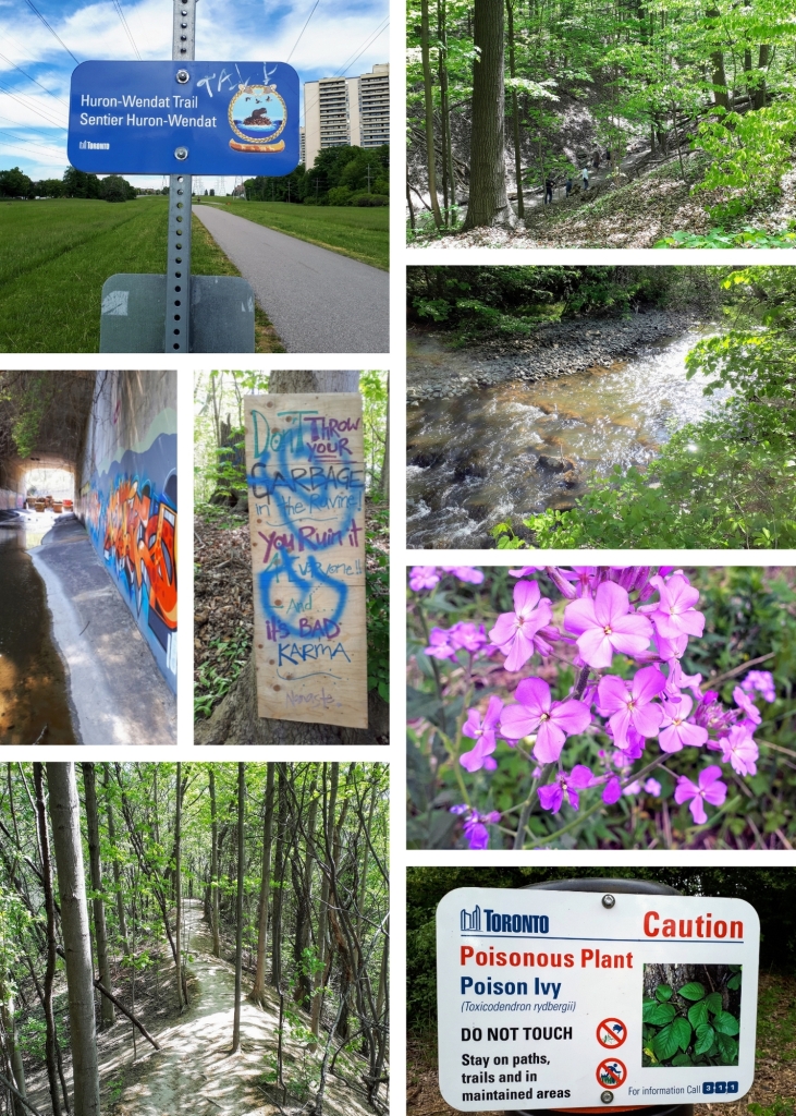
There’s something like 11,000 years of Indigenous history here. Where I live is the traditional territory of the Huron-Wendat, the Haudenosaunee, and the Anishinaabe peoples, including the Mississaugas of the Credit First Nation. It was fascinating to learn about those who have lived and travelled here before me, at signposted archaeological sites (such as the Parsons Site overlooking Black Creek, with a shout-out to Heritage Toronto’s plaquing program), along the Don, Humber, and Rouge Rivers, along the Lake Ontario shore, and in the heart of downtown too.
I spent more time in nature than I had in years, observing wildlife (great blue herons, salmon, turtles, mink, butterflies, a coyote), fields of wildflowers (white anemones, purple loosestrife, yellow black-eyed Susans), and a variety of landscapes (wetlands, beaches, parkland, forest).
Furthermore, I got a close look at some of the city’s water infrastructure, learning about gabion baskets, sewer overflows, and storm water management.
As a reality check, during this pandemic time, I also came across homeless encampments.
This short video on the City of Toronto’s Ravine Strategy gives a good illustration of the types of landscapes I saw during the year.
Here are some resources that were useful to me.
Itineraries and Maps:
- 11 City of Toronto Discovery Walks, all of which I followed (with some minor fudging for closed trails)
- City of Toronto Trails Map West and Trails Map East (oh how I wish these useful but 12+ year-old maps could be updated)
- AllTrails app
- MapMyWalk app
Books:
- Toronto’s Ravines and Urban Forests: Their Natural Heritage and Local History by Jason Ramsay-Brown (Lorimer, 2020)
- Where does it all come from? Where does it all go? Toronto’s water, energy, and waste systems by Mariko Uda (Ecomariko, 2020)
- An Enduring Wilderness: Toronto’s Natural Parklands by Robert Burley (ECW Press, 2017)
- Stroll: Psychogeographic Walking Tours of Toronto by Shawn Micallef (Coach House Books, 2010)
- Great Country Walks Around Toronto by Elliott Katz (Great North Books, 2006)
Further Reading:
- Wikipedia: Toronto Ravine System
- Toronto Ravine Strategy (opens a 66-page PDF)
- Toronto Field Naturalists
Health:
- Moleskin padding for blister prevention
- Spiky massage ball for plantar fasciitis (sigh)
Did I take a lot of photos of forests, flowers, and flowing water? Yes, I did. Here is a selection.
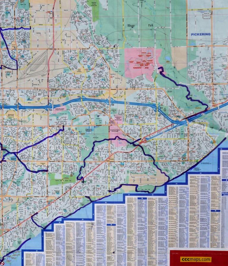
And finally, here is the eastern section of the map, showing Taylor Creek, Gatineau Corridor / Meadoway, Highland Creek, Rouge Park, and the Lake Ontario shoreline including Scarborough Bluffs.
I’m grateful to have had the chance to see more of the natural side of Toronto, and can’t wait to get back at it in 2022.