
Something very exciting is happening in Toronto right now: the $1.25-billion Port Lands flood protection project, which will open up a massive amount of undeveloped formerly industrial land in the heart of the city. Started in 2017, the project will have a huge impact on the waterfront area, actually rerouting the mouth of the Don River, creating a new island and public green space, and eventually new residential neighbourhoods too.
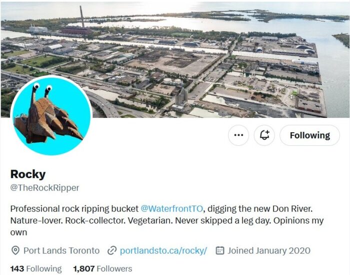
Though I’ve been observing the site from afar (welcome gorgeous new Cherry Street bridges!), I’ve found it very difficult to imagine how this feat will be accomplished, so have been avidly following the Twitter account of Rocky the Rock Ripper (@TheRockRipper), “Professional rock ripping bucket @WaterfrontTO, digging the new Don River.”
For background, here’s a video from Waterfront Toronto introducing the project.
I jumped at the chance to attend an educational event at the Royal Ontario Museum a couple weeks ago. On January 21, 2024, photographers Vid Ingelevics and Ryan Walker presented their work at a sold-out public program in the ROM’s Eaton Theatre: “Our Changing Port Lands – Documenting Toronto’s Journey to Climate Resiliency.”
Chronicling the momentous changes from the ongoing revitalization of Toronto’s Port Lands, artists Vid Ingelevics and Ryan Walker have spent years creating a photographic record of the changes in this corner of the city.
Their work captures many of the complexities of this important construction project, including landscape changes and portraits of the workers, and through their images, connect Torontonians to the most significant infrastructure project the city has ever undertaken to build climate resiliency on our waterfront. Through their camera lenses, explore the Port Lands’s transformation from a blank, postindustrial landscape to a restored river valley, and discover how the city is redefining its relationship with the Don River.
Hosted by ROM’s Soren Brothers, this program examines Toronto’s transforming identity as a climate leader in North America, how this project will forever change the city’s waterfront and our relationship with the iconic Don River, and the significance – and importance – of documenting that change.
I’d originally expected the program to be more about the construction technicalities of this huge infrastructure project, something in which I’m very interested due to walking in the area. However, to my joy, it was an exploration of the artists’ many many images of the site taken since their documentary project began in 2019.
It is particularly significant that Ingelevics and Walker are artists. Their images document aspects of the project, big and small, that might not otherwise be captured, on themes such as wildlife, nature, designated heritage structures, found objects, and portraits of the workers, and their work has annually been displayed at the CONTACT Photography Festival. This video shows their outdoor installation at the Port Lands, curated by Chloë Catan, from June 2021 to April 2022.
I obviously can’t share their photos, which are protected by copyright, but I encourage anyone interested to check them out online.
Photographs of the Changing Port Lands
https://portlandsto.ca/multimedia/photographs-of-the-changing-port-lands/
Panoramas
https://portlandsto.ca/multimedia/panoramas/
Portraits of People Who Work on Site
https://portlandsto.ca/multimedia/portraits/
For more information on the project visit Waterfront Toronto and Port Lands 2024 (especially the interactive project map, which I’ve found extremely helpful in visualizing the site).