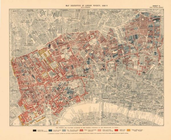
Warning: if you’re a London enthusiast, this post may sidetrack your day. A previous blog post was primarily about digital collections of London in images (photographs, prints, drawings, etc.). This post looks at the wider world of digital collections about London, including maps, in ten outstanding examples. As a parameter, I’ve included only collections that do not …